| <=prev |
|
About Misamis Occidental
page
1
|
|
|
BRIEF HISTORY
Legislative Act No. 3537 passed on November
2, 1929 divided the old province of Misamis into Misamis Occidental
and Misamis Oriental. The Occidental comprised the towns of
Baliangao, Lopez Jaena, Tudela, Clarin, Plaridel, Oroquieta,
Aloran, Jimenez, and Misamis.
The original nine (9) municipalities of the
province of Misamis Occidental grew into the present three
cities of Ozamiz, Oroquieta and Tangub and the fourteen (14)
municipalities of Aloran, Baliangao, Bonifacio, Calamba, Clarin,
Concepcion, Don Victoriano, Jimenez, Lopez Jaena, Panaon,
Plaridel, Sapang Dalaga, Sinacaban and Tudela with a total
of 490 barangays.
The name “Misamis” is believed
to have been derived from the Subano word “Kuyamis”
which is a variety of sweet coconut – the staple food
of the yearly settlers in this place. During the years the
name persisted as an inference of geographical location and
upon the advent of the Spanish settlers, the word “kuyamis”
easily gave way to the more conveniently pronounceable but
corrupted word “Misamis”.
GEOGRAPHY
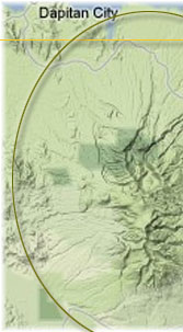
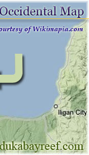
Misamis Occidental is located near the narrows
strip of land linking northwestern Mindanao to the north central
part of the island. It is bounded on the northeast by the
Mindanao Sea, east by the Iligan Bay, southeast by the Panguil
Bay and west by Zamboanga del Norte and del Sur. The fact
that three of its boundaries are bodies of water makes fishing
as one of its main industries.
Except along the coastal area, hilly and
rolling lands characterize the provincial terrain. Towards
the western border, the terrain is particularly rugged. The
province falls between 6 and 9 degrees east longitude.The
province has a total land area of 2,024.18 square kilometers
representing 65 percent of the total land area of the Philippines.
Tudela has the biggest land area equivalent
to 13.8 percent of the total province area. The municipality
of Panaon shares the smallest area of only 46.80 square kilometers.
CLIMATE
The climate belongs to the Fourth type where
rainfall is more or less fairly distributed throughout the
year. The average rainfall in the past twenty years was recorded
at 182.5 millimeters. The rainiest months are November and
December; the driest are February, March and April. The entire
province is outside the typhoon belt, but it is sometimes
affected by freak storms.
LANGUAGE/DIALECT
Cebuano, Tagalog, Subano and English
Province/
Municipality |
Population
(1999 Projection) |
Area
(in sq. km.) |
Misamis Occidental |
488,665 |
2024.18 |
Aloran |
23,716 |
118.06 |
Baliangao |
13,989 |
81.72 |
Bonifacio |
29,298 |
155.02 |
Calamba |
16,701 |
104.64 |
Clarin |
27,898 |
84.50 |
Concepcion |
5,342 |
61.60 |
Don Victoriano |
7,323 |
284.60 |
Jimenez |
22,821 |
81.43 |
Lopez Jaena |
21,767 |
94.70 |
Panaon |
9,215 |
46.80 |
Plaridel |
31,019 |
80.00 |
| Sapang Dalaga |
22,448 |
89.20 |
| Sinacaban |
15,689 |
75.59 |
| Tu dela |
24, 281 |
98.52 |
| Oroquieta City |
59,637 |
237.88 |
| Ozamiz City |
108,541 |
169.95 |
| Tangub City |
49,981 |
159.97 |
|